
Wild About the Lies Maps Tell
Maps are fully integrated into our lives in ways that they never have been before. We carry them with us everywhere, using them to generate directions, to check out a friend’s house on street view, or to plan a road trip or even a trip to a new grocery store. Whether they are on our phones or a hard copy on the wall, we expect maps to be accurate representations of the world around us. Depending on the scale, maps may not include every feature, but the ones they do include should be real and real features should be included.
Right?
Not exactly.
Maps, even the modern, digitally generated maps we have today are filled with inaccuracies and opinions.
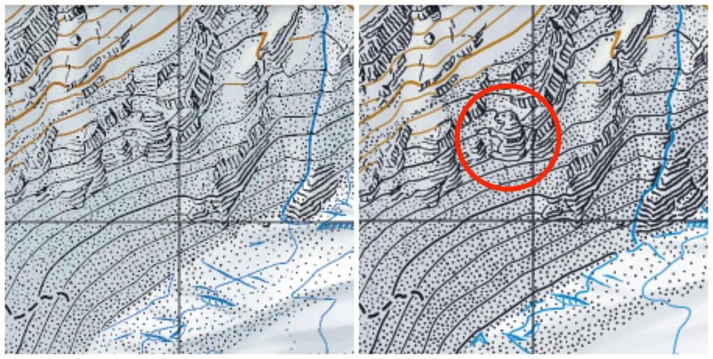
Adding inaccuracies into maps is something that has been done for decades, probably centuries. In some cases, such as the hidden features that have been drawn into Swiss maps, the inclusion of fish and marmots in the lakes and mountains of Switzerland has clearly been done for the cartographer’s amusement. Digital maps have opened up a wealth of opportunities to include entertaining Easter eggs. If you know where to look, Google maps includes fun surprises such as travel times by dragon or walking directions to Mordor.
Other inaccuracies are drawn on maps to deliberately trap copyright thieves who might be tempted to redraw a map and claim it as their own. Known as ‘trap streets’ or ‘paper towns,’ these features may appear completely real, until you try to visit in real life. Recent legal interpretations of copyright law have rendered the purpose of these phantom places obsolete, however, they live on, even in digital maps such as Google Maps, where paper towns have been discovered in New York and in the UK. These towns have since been removed, but who knows if there are others out there.

Not all inaccuracies are as innocuous as Easter eggs and paper towns. The digitization of maps means that features can be hidden for political or military reasons. Early versions of Google Earth blurred out sensitive features like military bases or presidential residences, although many of those features are visible on today’s maps.
Even without these deliberate mistakes and hidden features, cartographers know that there is no such thing as a completely accurate map. The nature of rendering our three-dimensional planet into a two-dimensional drawing requires choices to be made and a certain degree of accuracy is sacrificed. Beyond that, mapmaking is inherently political. Who makes the map and the story they are trying to tell influences the features that are included and how they are presented. Although we think of them as true representations of the world, they are tools that tell a specific story.
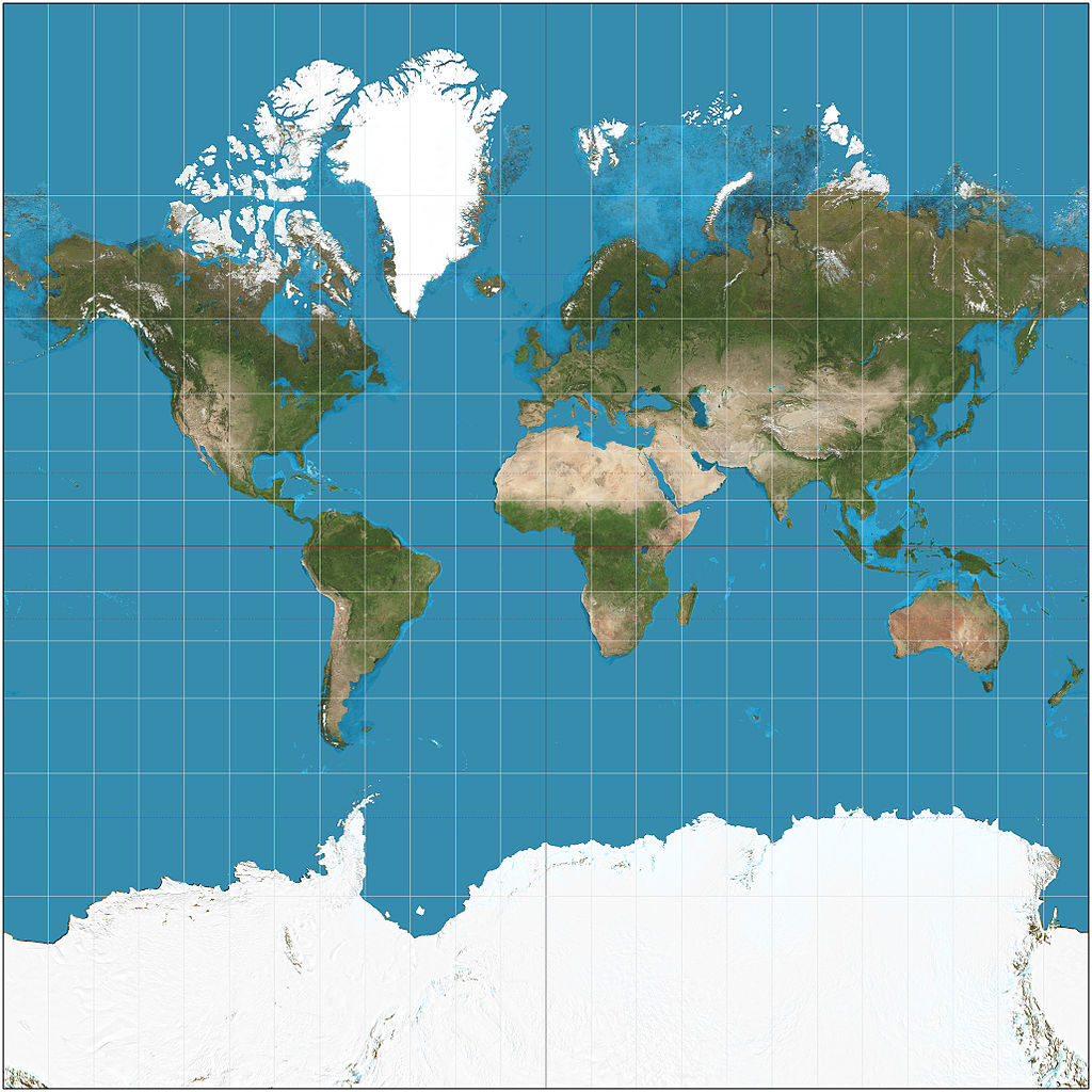
If you think of a map of the world, you almost certainly think of something called the Mercator projection. This map shows North America at the top, its land mass greater than the smaller representation of southern hemisphere continents such as Africa. This is despite the fact that Africa is, in fact, 6 million square kilometers larger than North America. The Mercator project, the one we use every day, exaggerates the size of continents in the northern hemisphere, making continents like Africa seem less important. The politicization of maps can be found online as well. For example, Google’s maps of the Crimea change depending on whether you are accessing the map from Russia or Ukraine.
Maps can be used to control—a line on a map can assert dominance and ownership, even over the objections of people who live there. Maps can also be empowering. Recent efforts to map indigenous traditional territories have increased awareness and have supported land claim settlements, as with the Tsilhqot’in land claim decision in 2014.

We take it for granted that maps are telling the truth, but the reality is that they are telling a truth. The map on your phone probably isn’t trying to trick you, but it might not be telling you the whole truth, either. Thinking about the story the mapmaker is trying to tell, the details they included and the features they omitted tells its own story. It’s something to think about the next time you need directions.

